

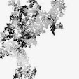
Pictured above is one of the maps from my Cloud Mesa mobile. My maps appear not to be representations of places; they are more like diagrams of exploration, migration, and settlement. Maps have long held a fascination for me, as they have for many others. Witness the recent spate of books about maps, such as those by Katharine Harmon, Frank Jacobs, and Peter Turchi. I can spend hours poring over a simple transit map.
As graphic objects, maps are both figurative and abstract -- they depict real places, reduced to their most salient features. They exert a seductive authority, organizing information with a sheen of objectivity. However, maps are drawn by mapmakers, who have agendas of their own: cartographers decide what features to show and omit; they label places with names that carry political and cultural biases; they sometimes use flawed data. Nonetheless, we treasure maps not only as practical tools, but as metaphors for knowledge and power (or knowledge as power).
One function of many maps is to delineate borders. When we locate ourselves on a map -- our state, our town, or our property lines -- we reinforce our mental boundaries, our sense of self. Boundaries establish identity. Boundaries lead to conflict. Boundaries foster movement (import/export of goods, gradient flow of fluids across a cell membrane). Boundaries sustain life (trees need bark, we need our skin). Psychologically, boundaries (beliefs) keep us from having to process too much information. Boundaries help us to make sense of it all.
The trick, I think, is to acknowledge our need for boundaries without allowing them to become limitations. Perhaps this is why I've been cutting up my maps to make mobiles -- to transcend my own personal borders and history, in the hopes of achieving a Zen-like balance with the world around me. So, not only am I making a profound postmodernist statement about the fragmentation of culture and society, I'm also getting some therapy out of it....



The Angel of Gratitude by Dee Sprague
15 years ago


No comments:
Post a Comment